Plan der Residenzstadt Potsdam und Umgebung
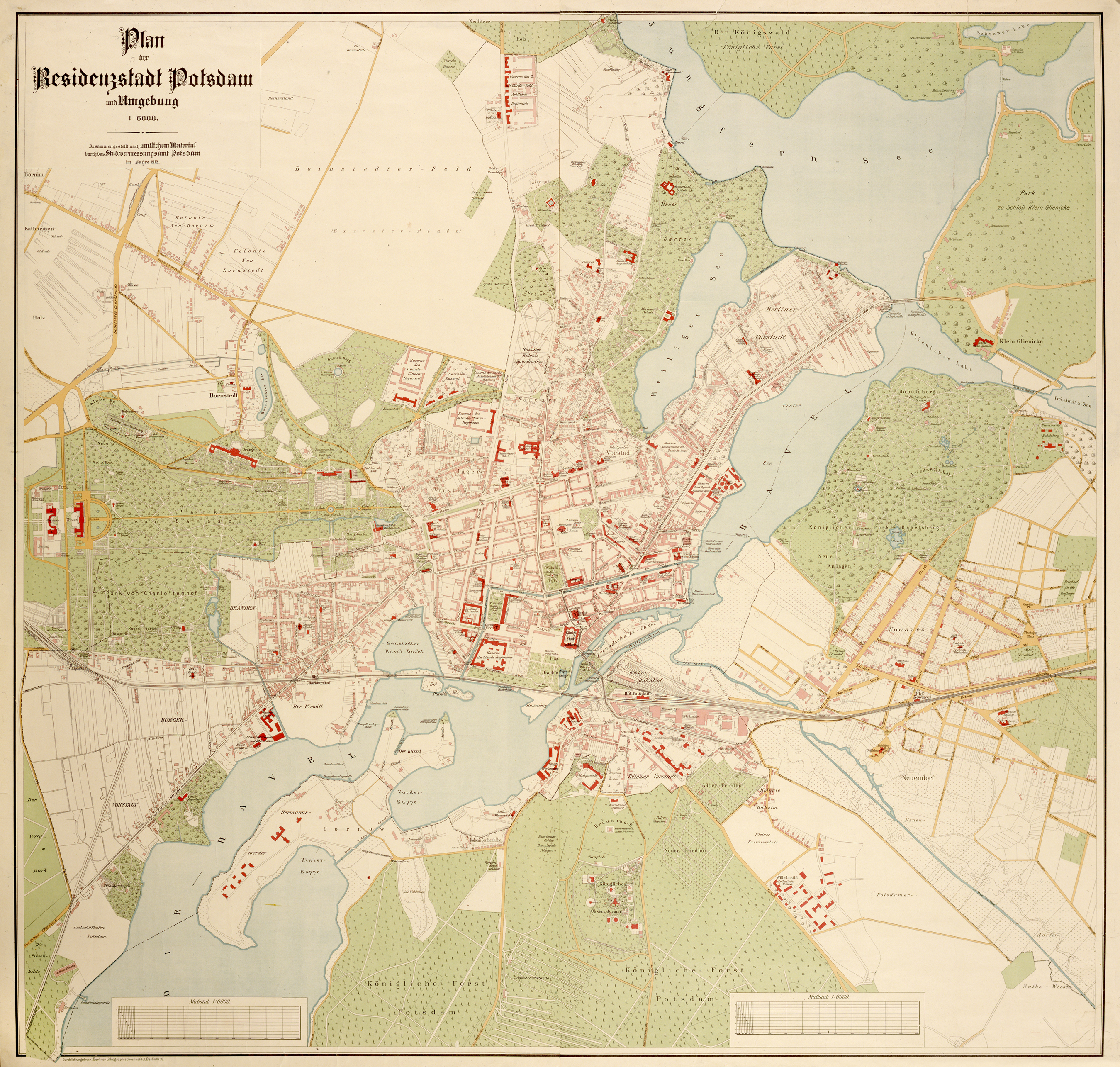
Als monochrome Grundkarte war der vom Stadtvermessungsamt Potsdam angefertigte Plan Grundlage sämtlicher nachfolgender bis in die 1930er Jahre erschienenen Pläne der Stadt. Im Zuge der Ausstellung "Potsdam mobil - Vekehrstechnik und Verkehrswege im Wandel der Zeiten" im Jahr 2000 gab das Potsdam Museum ein Faksimile des Plans heraus.
bez.:
o. li.: Plan / der / Residenzstadt Potsdam / und Umgebung / 1:6000. / Zusammengestellt nach amtlichem Material / durch das Stadtvermessungsamt Potsdam / im Jahre 1912.
u. li.: Durchlichtungsdruck. Berliner Lithographisches Institut. Berlin W. 35.
bez.:
o. li.: Plan / der / Residenzstadt Potsdam / und Umgebung / 1:6000. / Zusammengestellt nach amtlichem Material / durch das Stadtvermessungsamt Potsdam / im Jahre 1912.
u. li.: Durchlichtungsdruck. Berliner Lithographisches Institut. Berlin W. 35.
(Object from: Potsdam Museum - Forum für Kunst und Geschichte Original entry)
Material /Technique ...
Durchlichtungsdruck
Measurements ...
108 x 113 cm (Blattmaß)
[Relationship to location] ...
Potsdam
[Relationship to location] ...
Jungfernsee
[Relationship to location] ...
Heiliger See (Potsdam)
[Relationship to location] ...
Havel
[Relationship to location] ...
Glienicke Palace
[Relationship to location] ...
Babelsberg Palace
[Relationship to location] ...
Nowawes
[Relationship to location] ...
Luftschiffhafen Potsdam
[Relationship to location] ...
New Palace (Potsdam)
[Relationship to location] ...
Orangery Palace
[Relationship to location] ...
Sanssouci
[Relationship to location] ...
Sanssouci
[Relationship to location] ...
Alexandrowka (Potsdam)
[Relationship to location] ...
Babelsberg Park
[Relationship to location] ...
Berliner Vorstadt (Potsdam)
[Relationship to location] ...
Brandenburger Vorstadt (Potsdam)
[Relationship to location] ...
Teltower Vorstadt (Potsdam)
[Relationship to location] ...
Nördliche Vorstädte
[Relationship to location] ...
City Palace, Potsdam